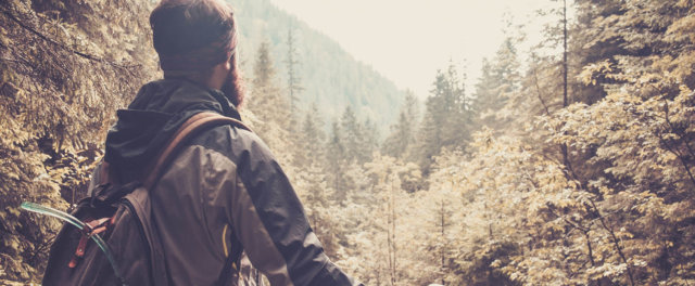
Biking in Wisconsin


Biking in Wisconsin. Biking is a healthy and family oriented experience that can be enjoyed by anyone, with any level of cycling ability, from challenging fat tire runs and single track to state biking trails. If you're looking for beautiful scenery and wildlife sightings, look no further. The following list of Wisconsin recreational biking trails, Wisconsin wildlife areas, state parks, and other appropriate biking venues are divided alphabetically by area or city. It contains phone numbers, location, trail length and a brief description of the trail and its facilities, when available.
A
| B | C | D
| E | F | G
| H | I | J
| K | L | M
| N | O | P
| Q | R | S
| T | U | V
| W | X | Y
| Z
Badger State Trail - Completed in 2007! Ribbon cutting for the Badger Trail was in Belleville on July 8, 2007.
(608) 527-2335.
Trail users to the Badger Trail will find they are connected to the Capital City, Military Ridge, and Sugar River state trails; Madison bikeway system; Capital Springs and New Glarus Woods state parks; Albany State Wildlife Area; Ice Age National Scenic Trail; thirteen communities in southern Wisconsin and northern Illinois; and numerous local parks. Between Monticello and Belleville in the town of Exeter, the trail goes trough the 980-foot-long, nearly 120-year-old Stewart Tunnel. Flashlights are recommended for going through the tunnel. The trail connects with the Illinois Jane Addams Trail at Wisconsin's southern border. 40 miles.
Balsam
Lake - Cat Tail Trail
(715) 485-9272.
18 miles. Beginner. This segment of Rails to Trails System runs
from Almena to Amery.
Baraboo - Devil's Lake State Park
608) 356-8301
Over 8 miles of off-road bike trails. Just 15 minutes
from Wisconsin Dells. Sandstone bluffs surround half the lake.
Baraboo - Merrimac Ferry Tour
(608) 592-4412
45 Miles. Moderate difficulty, some longer climbs. Trail head location is in Baraboo at Circus World Museum parking lot on Water Street (Hwy. 113).
Baraboo - Mirror Lake State Park
(608) 254-2333
Bicycles are only allowed on the Ice Age Loop and a
connector trail which provides about 8 total miles of bike trail.
Belmont
- Pecatonica State Park Trail
(608) 776-4870
14 miles. Intermediate. This segment of Rails to Trails System
connects Calamine to Belmont.
Berlin
- Rush Lake Trail
(920) 424-0042
5 miles. Beginner. This trail runs southeast from Berlin to
Ripon.
Black
River Falls - Black River State Forest
(715) 284-4103 or (800) 404-4008 I94 Exit 116
40 miles. Beginner/Advanced. Several different trails with various
surface types are offered.
Blue Mound State Park Trails
(608) 437-5711
10 miles. Beginner on Pleasure Valley Trail. Advanced on the single track trails. Location at Blue Mound State Park.
Boulder
Junction - Bearskin State Park Trail
(715) 385-2727
18 miles. Intermediate. This trail is a segment of the Rails
to Trails System.
Bristol
- Bristol Woods
7 miles. Intermediate. Located in Kenosha County.
Brown County - Reforestation Camp Trails
(920) 448-4466
11.4 miles. Beginner with a few areas of moderate difficulty. Location in Brown County Reforestation Camp Upper Parking Lot on County IR.
Burnett
- Gandy Dancer Trail
(800) 222-7655
95 miles. Intermediate. This trail is multi-purpose and has
snowmobilers and hikers during certain seasons.
Return
Cable - CAMBA Single-Track Trails
(800) 533-7454
12 miles. From Moderate to extreme for both trails. Hardpack forest floor, loose surface, rocks, and roots.
Cable - Chequamegon Area Trails
(800) 533-7454
Over 29 miles of trails which wind their way through the Chequamegon
National Forest. There is a nice mix of trails from beginner
to expert, gravel road to single track.
Calumet County - Calumet Park Trails
(888) 236-6673
3.6 miles. Beginner/ Intermediate/advanced. Location near the park office 7-mile north of County EE
Camp Douglas - Omaha Trail
(608) 847-9389
13 miles. Intermediate. This trail runs between Camp Douglas and
Elroy and is a multi-purpose County-operated trail. Daily trail passes are $2, $5 for season and are available at local businesses. The trail passes through a 875 foot tunnel, so a bring a flashlight! A picnic area and vault toilets are also at the tunnel area, which is approximately midway on the trail.
Chetek - Chetek Tour
(800) 317-1720
33 miles. Easy with some steep hills. Trailhead located at Southworth Memorial park 3.5 miles east of Chetek/County I on Country Park Rd.
Chippewa
Falls - Irvine Park:
(715) 723-0051
This is a two-mile gently rolling trail. The trail is located
in the city of Chippewa Falls on Hwy 124 North. For more information
call the Chippewa Falls Parks & Recreation.
Chippewa
Falls - Lake Wissota
(715) 723-0331
Located on Cty Hwy O, the park offers over 11 miles
of scenic trails that pass along Lake Wissota’s shoreline.
Although the trails are not developed for biking, bikes are
permitted on all but three of the trials. A State Park sticker
required.
Chippewa
Falls - Old Abe Trail
(715) 382-4574 or (888) 523-3866
20 miles. Beginner/Intermediate. This segment of the Rails to
Trails system runs from Chippewa Falls to Cornell and is located
just North of Eau Claire.
Clinton
- Pelishek Nature Trail
(608) 757-5450
7 miles. Intermediate. A segment of Rails to Trails.
Crandon
- Eds Lake
(715) 478-0088 or (800) 334-3387
6 miles. Beginner. Mostly easy with several moderate hills.
Located 2 miles East of Crandon on Hwy. 8 to Hwy. W.
Return
Darlington
- Cheese County Recreation Trail
(608) 776-4830
55 miles. Intermediate. This trail is one of the more diverse
segments of the Rails to Trails System which runs from Mineral
Point to Monroe and is a multi-purpose trail.
Delafield
- Glacial Drumlin State Park Trail
(262) 646-3025
49 miles. Intermediate. This trail is located in Waukesha County
and connects to Cottage Grove.
Dodgeville
- Military Ridge State Park Trail
(608) 935-5119
40 miles. Intermediate. 40 mile section of the Rails to Trails
System. This trail runs from Dodgeville to Fitchburg and is
a multi-purpose trail.
Door County - Peninsula State Park Trails
(800) 743-4456
12.5 miles. Mostly for beginner on wider trails. Location at Sunset Trail parking lot across Shore Rd. from the Park Office.
Douglas County - Osaugie Trail
(800) 942-5213
5.2 miles. Located at Richard Bong World War II Heritage Center in Superior on Hwy. 53.
Drummond
- Drummond Ski Trails
17 miles. Beginner/Intermediate. Open to bikers during the summer
season. Located near the Drummond Town Park Trails.
Drummond
- Drummond Town Park Mountain Bike Trails
(800) 533-7454
60.6 miles. Beginner/Intermediate. There are several trails
to choose from. Located at the intersection of Hwys. 35
& 63.
Return
Eau
Claire - Buffalo River State Park Trail
(414) 646-3025
36 miles. Intermediate. Multi-purpose trail located south of
Eau Claire.
Eau
Claire - Chippewa River State Trail
(888) 523-3866
20 miles. Beginner/Intermediate. Trail runs from Eau Claire
to Caryville. Available year round for outdoor activities.
Eau
Claire - Otter Creek Trail
3 miles. Intermediate. Located next to the Hill Crest Golf
Course.
Eau
Claire - Stage Coach Bicycle Route
(715) 831-2345 or (888) 523-3866
Approximately 21 miles round trip with alternate loops. Mostly easy but a few steep hills. A scenic
route that follows along a lightly traveled road and is perfect
for a family bicycle outing. Available year round and no
pass is required for route use. Trailhead located in Augusta just off Hwy. 12/27 on Stone St.
Elroy to Reedsburg - 400 State Trail
(800) 844-3507
22 miles, mostly level. Beginner to Intermediate. The 400 State Trail is located
between Reedsburg and Elroy with 5 communities conveniently
spaced along the trail to provide small town hospitality. Part
of the 101 mile State Trail System (Bike4Trails).
Elroy-Sparta State Trail
(608) 463-7109
32 miles. Intermediate. Trail is located on abandoned Chicago-Northwestern
Railroad which brings you through three famous rock tunnels.
Return
Fence
- Bass Lake
(715) 528-5377
40 miles. Intermediate. Located in Florence County.
Fitchburg
- Home to Four State Trails
The City of Fitchburg is home to four state trails: Capital City State Trail, Cannonball State Trail, Military Ridge State Trail and the Badger State Trail. Our bike-friendly city was the first community in the nation to incorporate a biking module into its SmartGrowth zoning code. You'll notice this significant detail as you bike through our urban centers with dedicated bike lanes or through our wide-open spaces of prairies, parks and forests. McKee Farms Park serves well as a starting point for your journey. You'll find that our scenery will help you relax, so you can simply enjoy the ride! Contact the Fitchburg Chamber of Commerce for a bike map at (608) 288-8284 or visit us at 5540 Research Park Drive.
Florence
- Lauterman Trail
10 miles. Intermediate. This trail borders Nicolet National
Forest.
Florence
- Ridge Trail
4 miles. Intermediate. Typical to the trails in the northern
Wisconsin area.
Florence
- Keyes Peak
(715) 528-5377
8 miles. Intermediate. Located near the Michigan state line.
Fort
Atkinson - Glacier River Trail
(262) 674-7260
4 miles. Beginner/Intermediate. The trail connects Fort Atkinson
to Koshkonong.
Return
Green
Bay - Baird Creek
(920) 448-4466 (Brown County Parks Dept.)
15 miles. Difficult. Single track with many crossings in the
creek and very steep inclines/declines.
Green Bay - Fox River Trail
(920) 448-6242
13.5 miles. The Trailhead of the Fox River Trail is located near downtown Green Bay at the junction of Porlier Street and Adams Street, just south of the Mason Street bridge. Parking near the trailhead is available on Adams Street, and on weekends in the lot located under the Mason Street Bridge. Parking is also available at the Fox Point Boat Launch facility, Voyageur Park, Bomier Boat Launch and the corner of Klaus and Follett Streets in Greenleaf.
Return
Hayward
- Hayward Trail System
33 miles. Intermediate/Advanced. This trail system starts with
the Mosquito Brook Trail where four separate trails begin.
Hillsboro
- Hillsboro Trail
(608) 847-9390
4 miles. Intermediate. Section of Wisconsin Rails to Trails
system. Connects with the 400 Trail.
Return
Janesville
The City of Janesville offers over 25 continuous miles of off-road paved bike trails. A map of these bike trails can be obtained by calling the Janesville Leisure Services Department at (608) 755-3030. These paved trails connect several beautiful parks such as Palmer, Rotary Gardens, Monterey, Rockport and numerous scenic greenbelts. For more information in trails and attractions contact the Janesville Convention and Visitors Bureau at (800) 487-2757.
Return
Kendall
- Elroy-Sparta State Trail
(608) 463-7109
32 miles. Intermediate. Trail is located on abandoned Chicago-Northwestern
Railroad which brings you through three famous rock tunnels.
Kettle
Moraine - Whitewater
((262) 495-2611 or ((262) 594-6200
21-30 miles. Intermediate. This trail is moderately easy and
perfect for the beginner to intermediate rider.
Kickapoo Valley Reserve Trail
(608) 637-2575
13.9 miles. Moderate to difficult with a number of long, steep stretches.
Return
La
Crosse - La Crosse River Trail
(608) 781-9570
21.5 miles. Intermediate. Has a five-mile prairie preserve. This trail is
a connecting link between the Elroy-Sparta State Trail and the
Great River State Trail.
LaGrange - John Muir Trail
10 miles. Intermediate. Located in the southern portion
of the Kettle Moraine State Forest.
Langlade
County - Ice Age Trail/Lumber Camp and Old RR Segments
(715) 627-6236
9 miles each. Intermediate. The Ice Age Trail is divided into
two segments, the Lumber Camp and the Old RR.
Lake Mills - Waterloo Tour
(920) 648-3585
33 Miles. Beginner. Trailhead location in Lake Mills at Commons Park at N. Main St. (Hwy. 89) & W. Madison St. (County B).
Return
Madison - Nine Springs & Capital City Trail
(800) 373-6376
17.8 miles total. Trailhead located near near the west end of the trail at Dahle Conservancy Park on Seminole Highway.
Madison - Quarry Park/Hermits Cove
3 miles. Advanced. Located behind Whole Foods on University
Ave.
Manitowish
- Iron Horse Trail
(715) 561-2697
55 miles. Intermediate. This trail is one of the longest on
the Rails to Trails System.
Manitowoc - Mariners & Rawley Point Trails
(800) 627-4896
5.5 miles. Located at the Manitowoc Marina parking lot on Hwy. 42.
Medford
- Pine Line
(800) 269-4505
26 miles. Advanced. One of the more advanced segments of the
Rails to Trails System and runs from Medford to Prentice.
Menomonie
- Red Cedar Trail
(715) 232-1242 or (888) 523-3866
15 miles. Intermediate. This trail connects Menomonie to Dunnville.
Available year round for outdoor activities.
Milwaukee
- Oak Leaf Trail
(414) 257-6100
96 miles. Intermediate. Recreation trail that travels through
the greater Milwaukee Area.
Monroe - Browntown-Cadiz Springs State Recreation Area
(608) 966-3777
1 mile. Bike along the lakes Beckman and Zander.
Return
Neillsville - Levis Trow Mounds Trails
(888) 252-7594
Over 25 miles of great singletrack, easy to extreme. Located near junction of Hwy. 96 and County J, 12 miles southwest of Neillsville.
New Glarus - Sugar River State Trail
(608) 527-2334 (summer) or (608) 527-2335 (off-season), 418 Railroad Street, New Glarus, WI 53574. The
23-mile long
limestone-surfaced trail is used for bicycling, hiking, snowmobiling. A mile in New Glarus is blacktopped and also used for in-line skating.
Return
Oliver
- Oliver-Wrenshall Trail
(715) 378-2219 (Douglas County Forest Dept.)
12 miles. Intermediate. A segment of the Rails to Trails System
taking you from Mid-western Wisconsin to Mid-eastern Minnesota.
Onalaska - The Great River State Trail
(608) 781-9570
22 miles. Intermediate. Has the magnificence of the Mississippi River and its palisades.
Travels through 2 National Wildlife refuges, along Lake Onalaska
and over a 287' Steel Span Bridge over the Black River and over
19 waterways.
Ozaukee County - Interurban Trail
(800) 403-9898
30 miles. Located in Mequon at Loggamon Community Center on Hwy. 167.
Return
Racine - Kenosha County Bike Trail
(262) 857-1862
14 miles. Intermediate. Trail travels north and south to the
Illinois state line.
Racine
- MRK Trail
(262) 886-8440
5 miles. Beginner. This trail is a part of the Wisconsin Rails
to Trails and is a multi-purpose trail.
Rhinelander
- Washburn Lake
15 miles. Intermediate. These trails are three of six trails
found in the area.
Rhinelander-
Hanson Lake
4 miles. Intermediate. West of State Hwy. 47, East of the airport.
Rhinelander/Merrill
- Lincoln Co. ATV Trail/Co. Forest
Intermediate/Advanced. The ATV trail runs north and south,
12 miles either way. The Ice Age Trail crosses in several places
and is open to bikes in this section.
Return
Seeley
- Silverthorn Park
14.6 miles. Intermediate/Advanced. From Seeley take Hwy.
63 N. 1/2 mile to Park Rd. Take a left on Park Rd. and follow
it to Silverthorn Park.
Solon
Springs - Saunders Grade Recreation Trail
(715) 378-2219
8 miles. Intermediate. This trail runs from Solon Springs to
Lake Superior.
Elroy-Sparta
State Trail
(608) 463-7109
32 miles. Trail is located on abandoned Chicago-Northwestern
Railroad which brings you through three famous rock tunnels.
St. Croix Falls - State Gandy Dancer Trail
(715) 483-3580
This 98 mile recreational trail follows the old Soo Line railroad
grade from St. Croix Falls north to Superior.
Stevens
Point - Green Circle
26 miles. Intermediate. This trail goes all the way around
the city of Stevens Point.
Sturgeon
Bay - Ahnapee State Park Trail
(414) 746-2890
15 miles. Intermediate. Located north of Green Bay.
Sturgeon Bay - Cave Point Tour
(800) 527-3529
40 Miles. Easy/Beginner. Attractions on the way include: Door County Maritime Museum, Door County Historical Society, Miller Art Museum, and Third Avenue Playhouse.
Sturtevant
- Burlington Trail
(262) 886-8440
4 miles. Beginner. Located near the University of Wisconsin
Parkside South of Racine.
Return
Three Lakes
(888) 972-6103
33 Miles. Easy. Trailhead located at Cy Williams Memorial Park on Hwy. 32 in Three Lakes.
Tomahawk - Hiawatha Trail
(715) 536-0367
6 miles. Beginner/Intermediate. This segment of the Rails to Trails System runs from Tomahawk to Sara Park.
Trempealeau County - Peaceful Kingdom Ride
(800) 927-5339
29 Miles. Very Difficult, option for easy route open. Trailhead location in Dodge at Sportsmans Park on Cty. J.
Return
Vilas County - BATS-Crystal Lake Trail
(800) 466-8759
11 miles. Located at Boulder Junction Town Park on Cty. M
Vilas County - Razorback Ridge Trails
(888) 722-3789
20 Miles of double track cross country ski trails. Easy to extreme. Located at Razorback Ridges trailhead parking area on Razorback Rd. just north of County N. 3 Miles west of Sayner.
Return
Walworth County - John Muir Trail
(800) 395-1020
10 miles for the Blue outer loop. Most all trails are very difficult. Located at the John Muir Trails parkin lot on Cty. H 1.5 miles north of La Grange.
Waukesha
- Bugline Trail
(262) 548-7790
13 miles. Beginner/Intermediate. This segment of the Rails to
Trail System is located in Waukesha County.
Waukesha
- New Berlin Trail
(262) 548-7790
6 miles. Beginner. Located in Waukesha.
Waupaca - Chain O' Lakes Tour
(715) 258-2372
24 Miles for outer loop, 14 miles for the east loop, and 18 miles for the west loop.Beginner/Moderate. Series of steep hills on west loop.
Wautoma
- Bannerman Trail
(262) 787-7037
7 miles. Beginner/Moderate. Located East of Oshkosh at Hwys.
21 & 73.
Return